
The Corona pandemic has caused us to stay with the boat in the Caribbean during the hurricane season. In this post, I have compiled some information about Caribbean hurricanes and storms. We have done this to get an idea of how common hurricanes are, where they go and what effects to expect.
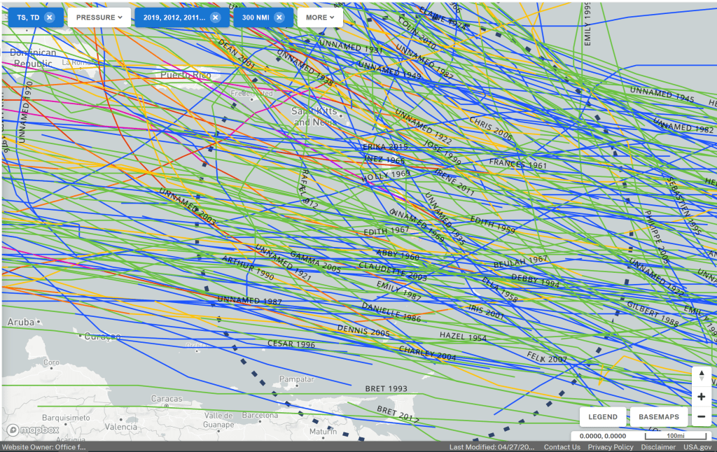
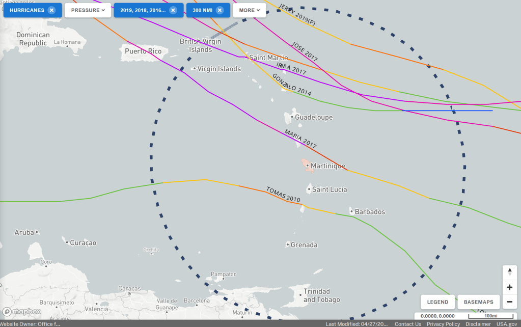
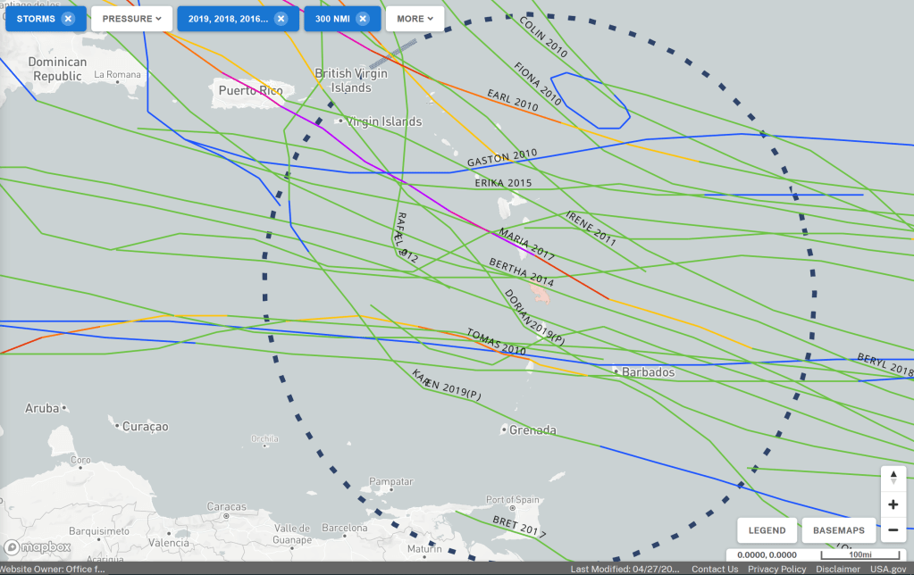
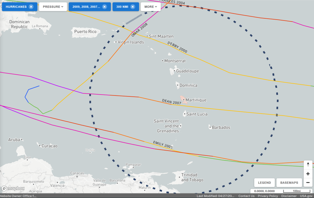
The two screenshots from NOAA Historical Hurricane Tracks, show the tracks from hurricanes and storms the last 100 years in the Caribbean.

Some facts
Each tropical storm and hurricane is named by the weather service in the United States and the strength is categorized according to the Saffir-Simpson scale given in the table below. The color in the table below is used in the maps showing hurricane tracks.
| Color | Category | Wind (m/sec) | Storm Surge (m) | Damage on land |
 | Category 5 | > 68 | > 6 | Catastrophic |
 | Category 4 | 57 – 68 | 4 – 6 | Extreme |
 | Category 3 | 48 – 57 | 3 – 4 | Extensive |
 | Category 2 | 41 – 48 | 2 – 3 | Moderate |
 | Category 1 | 32 – 41 | 1 – 2 | Minimal |
 | Tropical storm | 17 – 32 | 0 – 1 | Small |
 | Tropical depression | > 17 | 0 | No |
As a rule, storms in the North Atlantic occur and move from east to west or northwest across the Caribbean. Storms that occur in the Caribbean usually move from west to northeast. As the hurricane’s ”eye” approaches, a water rise occurs due to the wind pushing water in front of it towards land. Inside the eye it is calm and the eye is often 30 to 60 km in diameter. The harshest winds are just outside the hurricane’s eye and the hardest wind blows in the direction of the hurricane, ie. on the northern side of hurricanes coming from the Atlantic and on the southern side when coming from the Caribbean. Another thing to keep in mind is that it still can be storm winds as far as 150 km from the center of a category 5 hurricane.
There is much more to read about hurricanes online, here are some links to pages at NOAA, which publish useful information on the Earth’s atmosphere and ocean.
Historical hurricane tracks
History shows how it has been, not how it will be. With historical data from many years, you can at least see in which area there are hurricanes and how often.
In order to form our own idea of how common hurricanes are, we have looked at hurricane history for the Caribbean. On the site coast.noaa.gov you will find information about the paths for all tropical storms and hurricanes in the Caribbean since 1842. The color of the tracks shows how strong the hurricane or storm was. Sometimes a track changes color and that shows that the storm has become stronger or weaker.
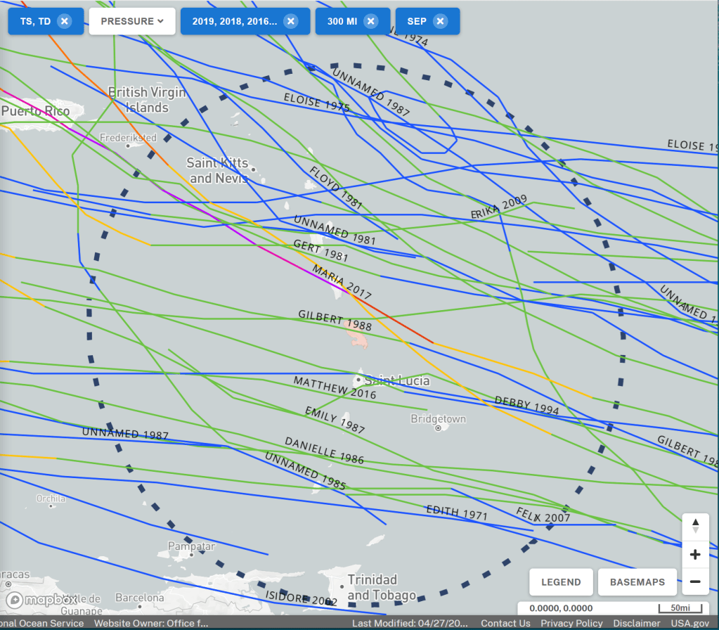
Tracks by year
Each row of images has storms and hurricanes from a 10-year period and the left image shows tracks of hurricanes while the right shows storms and depressions. We have made this breakdown partly to more easily see how common it is with Category 3 hurricanes and up, and how often they occur.
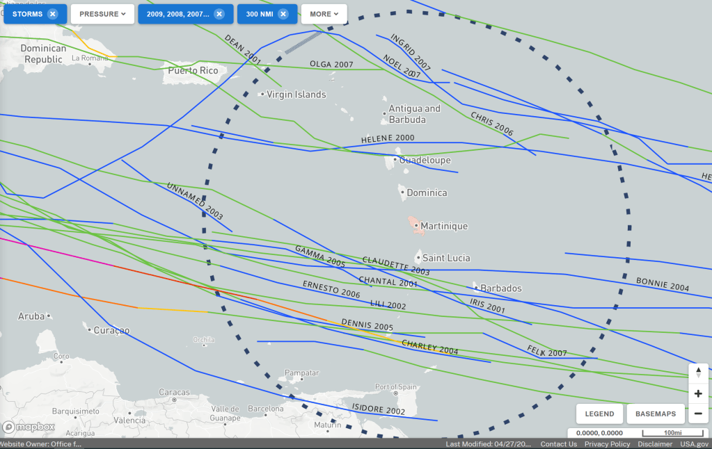
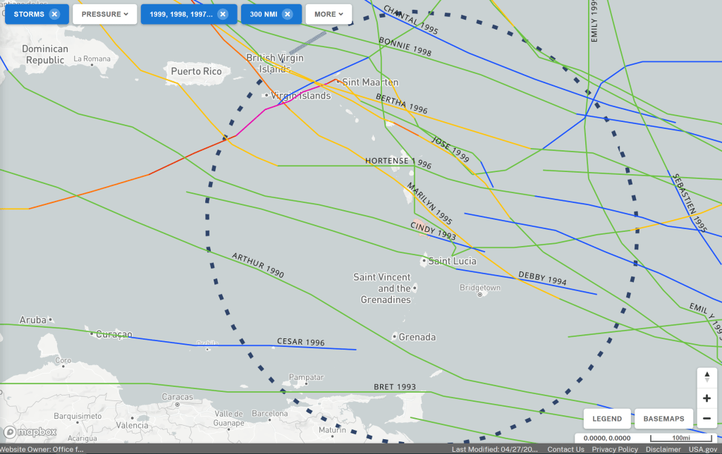


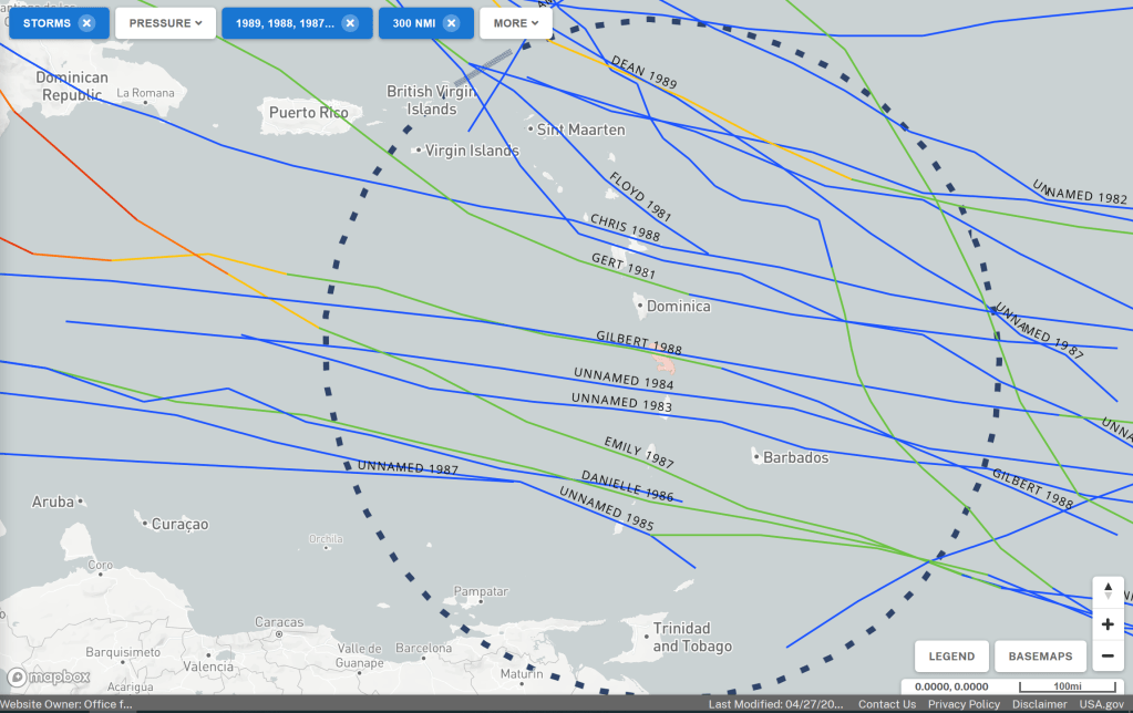
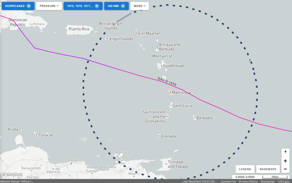


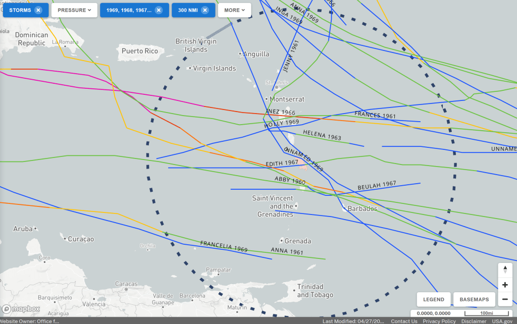


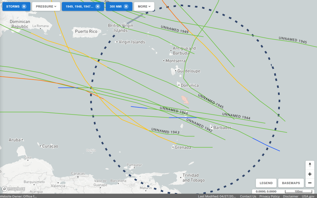
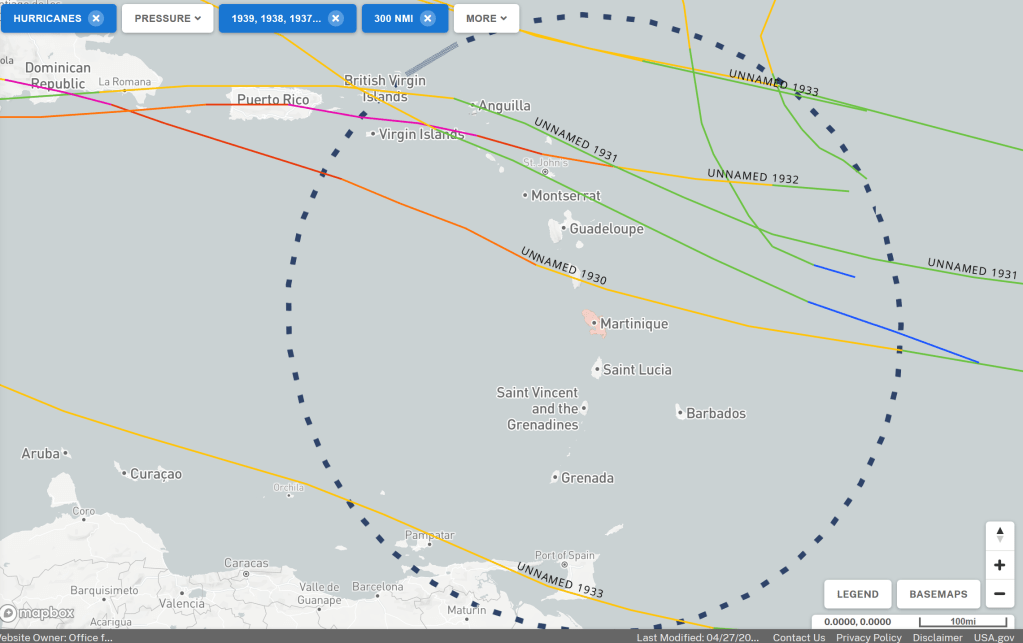
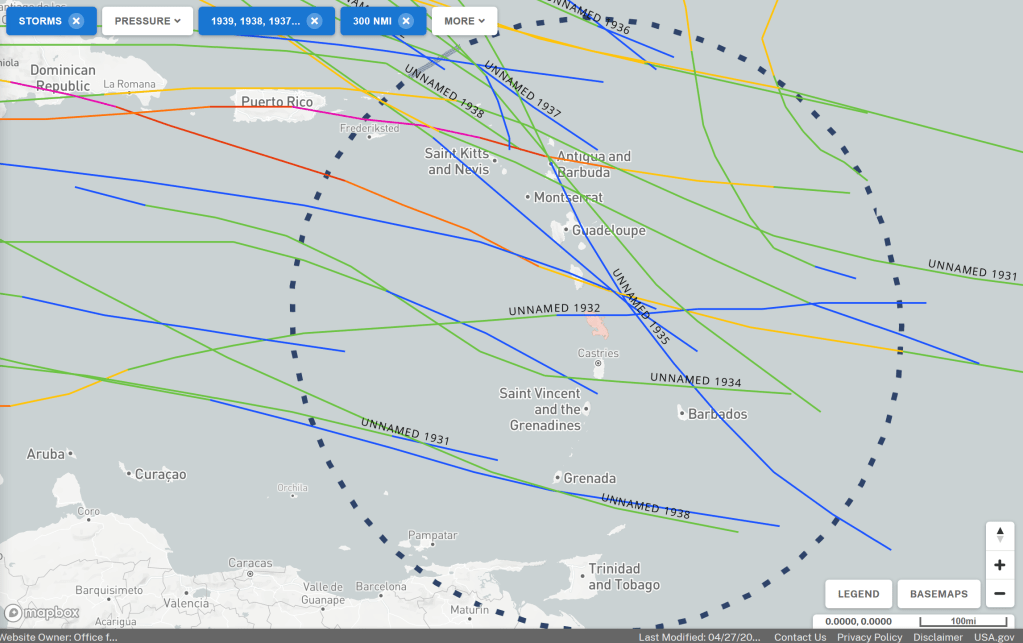

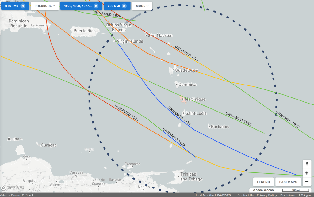
The tracks show that there are more hurricanes further north in the Caribbean. There are several storms and hurricanes around Guadeloupe each 10 year period. Grenada has had a few storms or hurricanes in each 10-year period, while Trinidad has only been hit by storms twice in a hundred years. However, no hurricane has passed over Trinidad.
Tracks by month
Each row of images has storms and hurricanes from one month during the hurricane season (June to December) in total for the years 1970 – 2019. The left image shows traces of hurricanes while the right one shows traces of storms and gales. We have made this division partly to make it easier to see when hurricanes are becoming more common and in which areas they occur during the season.

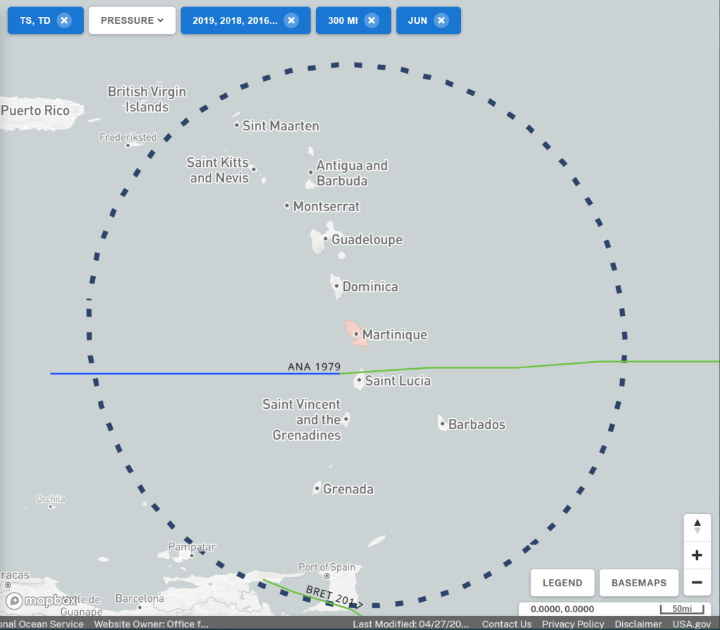
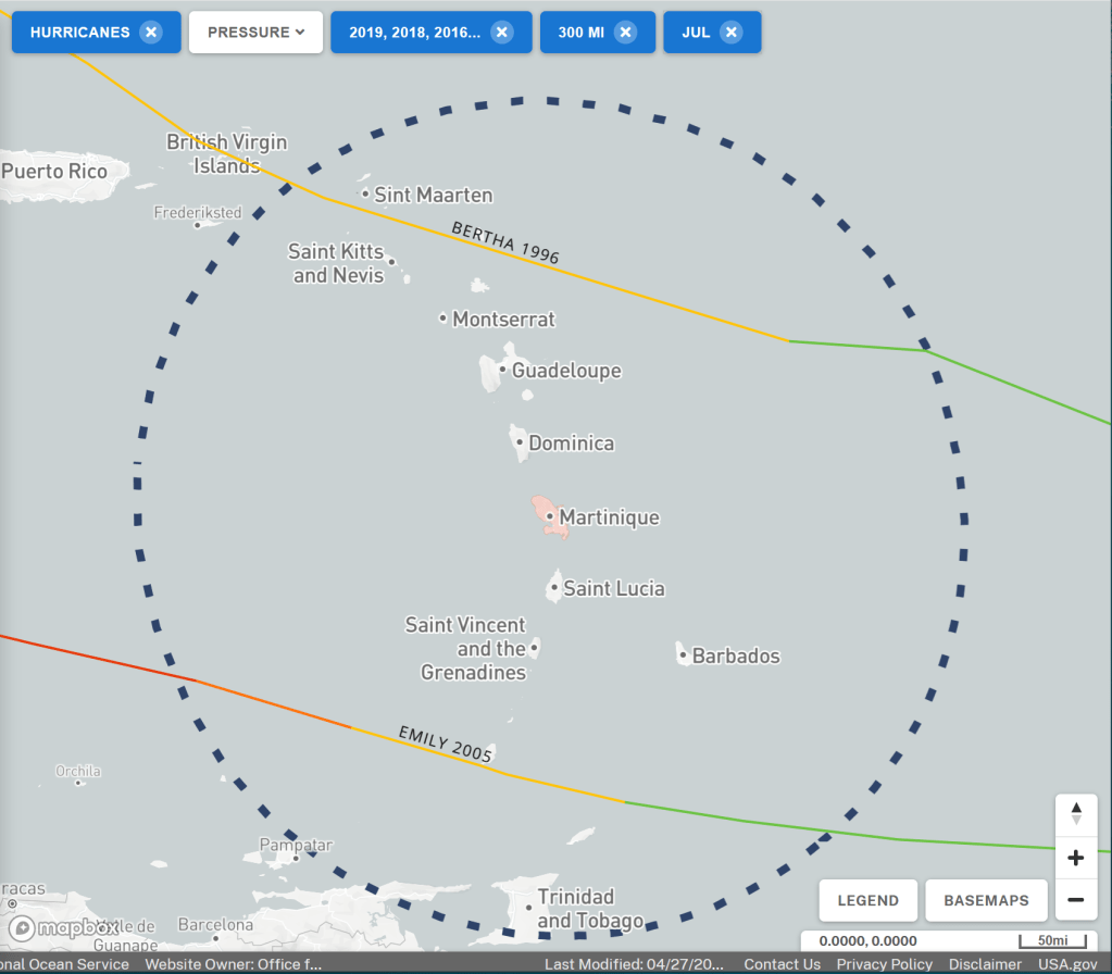

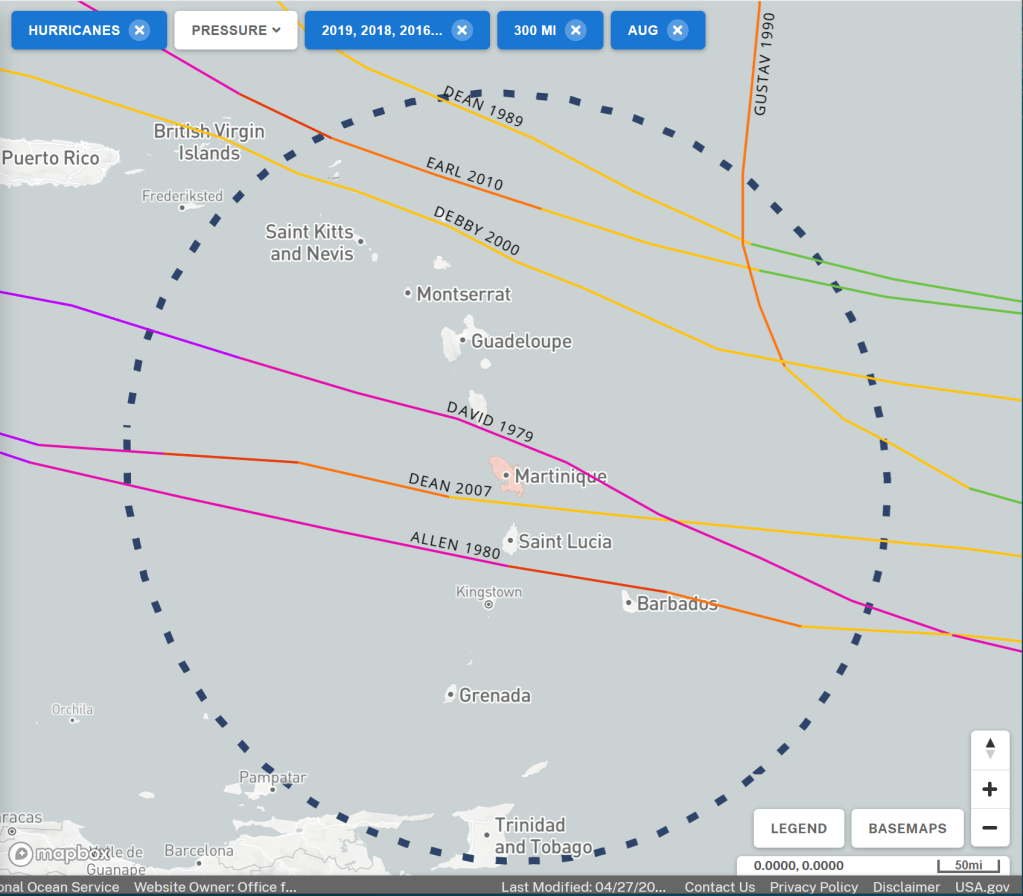


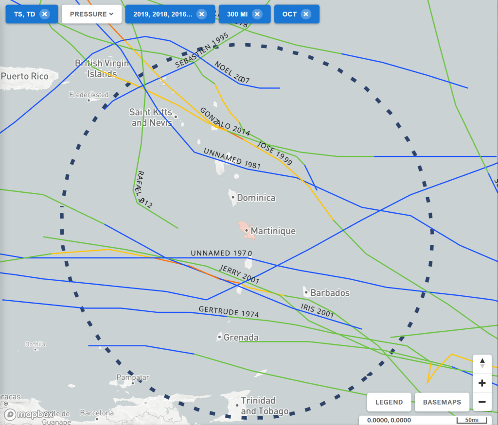
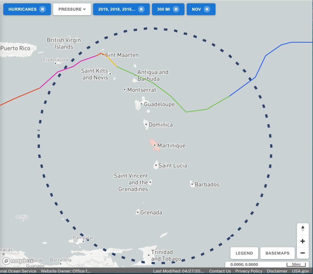

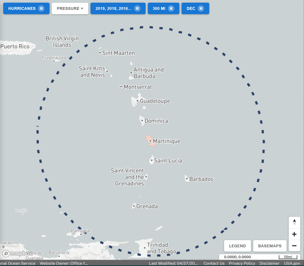
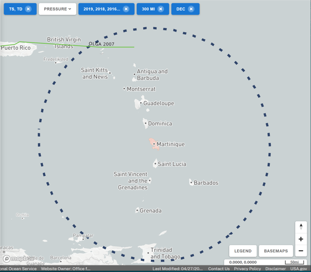
Low pressure often changes category during the passage through the area and in those cases I have categorized the track to the highest category it had at the passage. Such a track is counted only once. If a track starts like a storm and then is upgraded to hurricane 1, it counts as if a hurricane has passed.
This grouping of the tracks for the latest 50 years shows
- June, 0 hurricanes and 1 storm, which corresponds to a 2% risk of wind over 48 knots
- July, 2 hurricanes and around 6 storms, which corresponds to a 16% risk of wind over 48 knots
- August, 7 hurricanes and 18 storms, which corresponds to a 50% risk of wind over 48 knots
- September, 12 hurricanes and 17 storms, which corresponds to a 58% risk of wind over 48 knots
- October, 5 hurricanes and 5 storms, which corresponds to a 20% risk of wind over 48 knots
- November, 1 hurricane and 1 storm, which corresponds to a 4% risk of wind over 48 knots
- December, 0 hurricanes and 1 storm, which corresponds to a 2% risk of wind over 48 knots
What we see is that there is very little risk of deep low pressures in June, November, and December. The months you need to look out for, are August to October and then especially in the northern parts of the area.
Insurance
All boats must have liability insurance that protects the owners against damage to third parties caused by their own boat. It also means that those who suffer damage from your boat receive compensation, so it is also a responsibility towards others. This is very important and most marinas require that you can show that you have such insurance. For this insurance to apply during hurricane season in connection with a named tropical storm, it must be supplemented with insurance for Named Tropical Storms.
Each insurance company has its own definition of which area and which dates the hurricane season covers. This supplementary insurance has additional conditions for how the boat is to be moored, anchored, set up on land, what is reimbursed, etc.
Final note
Even if the risk of getting in the way of a hurricane is small when you are on the boat and have the opportunity to sail away, I still think that you should think about events that make you unable to sail away and how to handle them.
- Something happens to the boat that makes it unsafe to sail with it. For example, something breaks and there are no spare parts that take a long time to get hold of.
- Someone in the crew becomes ill or has an accident that makes it impossible to move the boat for a period of time.
- You are limited to sailing away as you wish due to government intervention, for example as has happened now during the covid-19 pandemic with closed borders.

Ett svar till “100 years of Caribbean hurricanes”
Have updated the post with some information about the distance from a category 5 hurricane center that is affected by storm winds (< 24 m/s)
GillaGillad av 1 person